python-python用pychart库,实现将经纬度信息在地图上显示
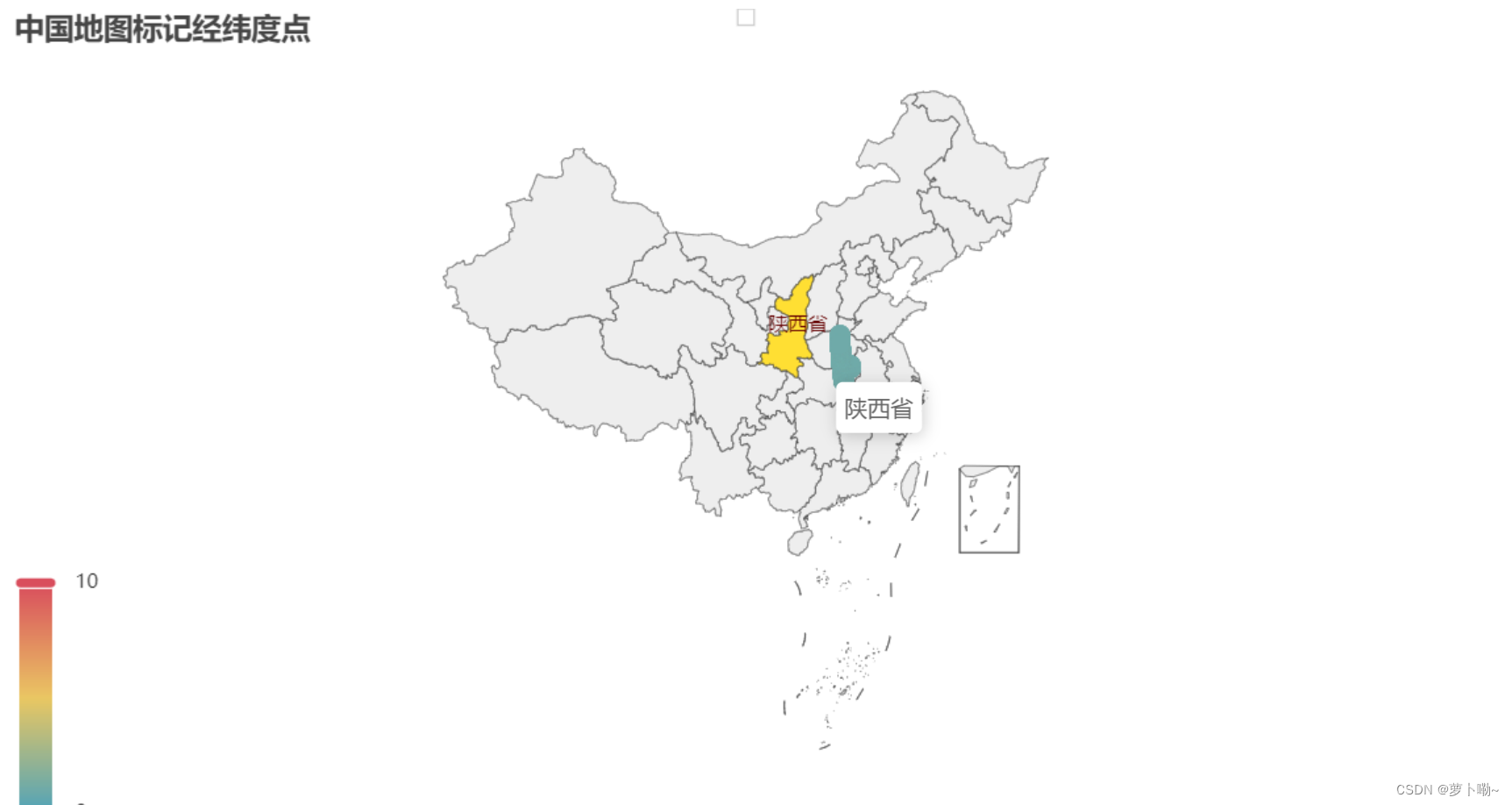
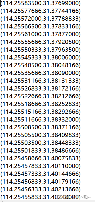
推荐 原创python使用pyecharts对给到的经纬度数据进行位置标注,下面是批量更新。给入数据,将地图生成。实验数据在下面附件。
from pyecharts import options as opts
from pyecharts.charts import Geo
import os

folder_path = 'F:\\GPS'
file_names = os.listdir(folder_path)
for file_name in file_names:
    geo_chart = Geo()
    open_path = folder_path+"\\"+file_name
    geo_chart.add_schema(maptype="china")
    with open(open_path, "r") as file:
        lines = [line.strip() for line in file.readlines()]

    points = [eval(line) for line in lines]

    for i, point in enumerate(points):
        geo_chart.add_coordinate(str(i), point[0], point[1])
    geo_chart.set_global_opts(
        title_opts=opts.TitleOpts(title="中国地图标记经纬度点"),
        visualmap_opts=opts.VisualMapOpts(max_=10),
    )

    for i, point in enumerate(points):
        geo_chart.add("", [(str(i), 1)])
    geo_chart.set_series_opts(
        effect_opts=opts.EffectOpts(symbol="circle", symbol_size=8, color="blue"),
        label_opts=opts.LabelOpts(is_show=False),
    )
    save_path = "F:\\GPS\\"+file_name[:-4]+".html"
    geo_chart.render(save_path)
    file.close()
    print(save_path)
结果:

资源内容如下:

更多【python-python用pychart库,实现将经纬度信息在地图上显示】相关视频教程:www.yxfzedu.com
相关文章推荐
- jvm-JVM-虚拟机的故障处理与调优案例分析 - 其他
- 编程技术-安卓调用手机邮箱应用发送邮件 - 其他
- 编程技术-C语言仅凭自学能到什么高度? - 其他
- 编程技术-春秋云境靶场CVE-2022-32991漏洞复现(sql手工注入) - 其他
- 编程技术-java 将tomcat的jks证书转换成pfx证书 - 其他
- 编程技术-任意注册漏洞 - 其他
- 安全-赛宁网安入选国家工业信息安全漏洞库(CICSVD)2023年度技术组成员单 - 其他
- jvm-深入理解JVM虚拟机第二十四篇:详解JVM当中的动态链接和常量池的作用 - 其他
- 编程技术-ROS 通信机制 - 其他
- 聚类-无监督学习的集成方法:相似性矩阵的聚类 - 其他
- layui-layui 表格(table)合计 取整数 - 其他
- 编程技术-rt-hwwb前端面试题 - 其他
- node.js-Vite和Webpack区别 - 其他
- python-python用pychart库,实现将经纬度信息在地图上显示 - 其他
- node.js-Electron-vue出现GET http://localhost:9080/__webpack_hmr net::ERR_ABORTED解决方案 - 其他
- web安全-APT攻击的特点及含义 - 其他
- 51单片机-51单片机应用从零开始(二) - 其他
- objective-c-【Objective-C】Objective-C汇总 - 其他
- 云原生-SpringCloud微服务:Eureka - 其他
- react.js-react+星火大模型,构建上下文ai问答页面(可扩展) - 其他
记录自己的技术轨迹
文章规则:
1):文章标题请尽量与文章内容相符
2):严禁色情、血腥、暴力
3):严禁发布任何形式的广告贴
4):严禁发表关于中国的政治类话题
5):严格遵守中国互联网法律法规
6):有侵权,疑问可发邮件至service@yxfzedu.com
近期原创 更多
- CTF对抗-STL容器逆向与实战(N1CTF2022 cppmaster wp)
- Pwn-DamCTF and Midnight Sun CTF Qualifiers pwn部分wp
- 软件逆向-OLLVM-deflat 脚本学习
- 软件逆向-3CX供应链攻击样本分析
- Pwn-从ciscn2022半决赛一道一解题浅析msg_msg结构体
- Android安全-XposedJnitrace
- 软件逆向- Windows .lib 文件后门注入
- Android安全-对某apk的一次插桩记录
- 智能设备-使用FirmAE 对zyxel路由器固件仿真实践
- 二进制漏洞-Windows_AFD_LPE_CVE-2023-21768分析
